Transform a simple tiff into geotiff
By bruno combal on Monday, February 22 2010, 15:26 - Permalink
How to transform a simple tiff, or any image, into a georeferenced image, for example a geotiff. Quite simple with gdal_translate.
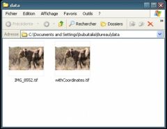
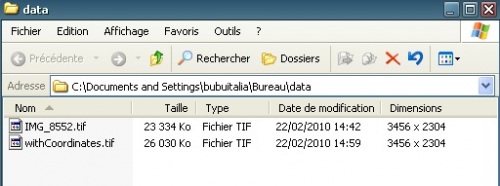
For this example, I took a random image, actually a photo of two elephants I took in Botswana. gdalinfo gives the following information about this image:
Driver: GTiff/GeoTIFF
Files: IMG_8552.tif
Size is 3456, 2304
Coordinate System is `'
Metadata:
TIFFTAG_DATETIME=2009:08:22 09:22:37
TIFFTAG_XRESOLUTION=72
TIFFTAG_YRESOLUTION=72
TIFFTAG_RESOLUTIONUNIT=2 (pixels/inch)
Image Structure Metadata:
INTERLEAVE=PIXEL
Corner Coordinates:
Upper Left  (    0.0,    0.0)
Lower Left  (    0.0, 2304.0)
Upper Right ( 3456.0,    0.0)
Lower Right ( 3456.0, 2304.0)
Center      ( 1728.0, 1152.0)
Band 1 Block=3456x12 Type=Byte, ColorInterp=Red
Band 2 Block=3456x12 Type=Byte, ColorInterp=Green
Band 3 Block=3456x12 Type=Byte, ColorInterp=Blue
Driver: GTiff/GeoTIFFFiles: IMG_8552.tifSize is 3456, 2304
Coordinate System is `'Metadata:  TIFFTAG_DATETIME=2009:08:22 09:22:37  TIFFTAG_XRESOLUTION=72  TIFFTAG_YRESOLUTION=72  TIFFTAG_RESOLUTIONUNIT=2 (pixels/inch)
Image Structure Metadata:
INTERLEAVE=PIXEL
Corner Coordinates:Upper Left  (    0.0,    0.0)
Lower Left  (    0.0, 2304.0)
Upper Right ( 3456.0,    0.0)
Lower Right ( 3456.0, 2304.0)
Center      ( 1728.0, 1152.0)
Band 1 Block=3456x12 Type=Byte, ColorInterp=RedBand 2 Block=3456x12 Type=Byte, ColorInterp=GreenBand 3 Block=3456x12 Type=Byte, ColorInterp=Blue
As you can see there is absolutely no geographic information yet. Let’s says, even if it is absurd for this photo, that the corners are geolocated. gdal_translate options -a_ullr ulx uly lrx lry overrides the georeferenced bounds of the ouptut file and -a_srs srs_def overrides the projection for the output file.
Let’s give it a try:
gdal_translate -of gtiff -co "compress=LZW" -a_ullr -26 38 0 0 -a_srs "wgs84" IMG_8552.tif withCoordinates.tif
Now the result is georeferenced, as demonstrated by gdalinfo:
Driver: GTiff/GeoTIFF
Files: withCoordinates.tif
Size is 3456, 2304
Coordinate System is:
GEOGCS["WGS 84",
DATUM["WGS_1984",
SPHEROID["WGS 84",6378137,298.2572235630016,
AUTHORITY["EPSG","7030"]],
AUTHORITY["EPSG","6326"]],
PRIMEM["Greenwich",0],
UNIT["degree",0.0174532925199433],
AUTHORITY["EPSG","4326"]]
Origin = (-26.000000000000000,38.000000000000000)
Pixel Size = (0.007523148148148,-0.016493055555556)
Metadata:
AREA_OR_POINT=Area
TIFFTAG_DATETIME=2009:08:22 09:22:37
TIFFTAG_XRESOLUTION=72
TIFFTAG_YRESOLUTION=72
TIFFTAG_RESOLUTIONUNIT=2 (pixels/inch)
Image Structure Metadata:
COMPRESSION=LZW
INTERLEAVE=PIXEL
Corner Coordinates:
Upper Left  ( -26.0000000,  38.0000000) ( 26d 0'0.00"W, 38d 0'0.00"N)
Lower Left  ( -26.0000000,   0.0000000) ( 26d 0'0.00"W,  0d 0'0.01"N)
Upper Right (   0.0000000,  38.0000000) (  0d 0'0.01"E, 38d 0'0.00"N)
Lower Right (   0.0000000,   0.0000000) (  0d 0'0.01"E,  0d 0'0.01"N)
Center      ( -13.0000000,  19.0000000) ( 13d 0'0.00"W, 19d 0'0.00"N)
Band 1 Block=3456x1 Type=Byte, ColorInterp=Red
Band 2 Block=3456x1 Type=Byte, ColorInterp=Green
Band 3 Block=3456x1 Type=Byte, ColorInterp=Blue
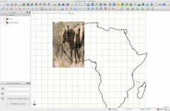
and QuantumGis can easily use this image as geospatial raster:


